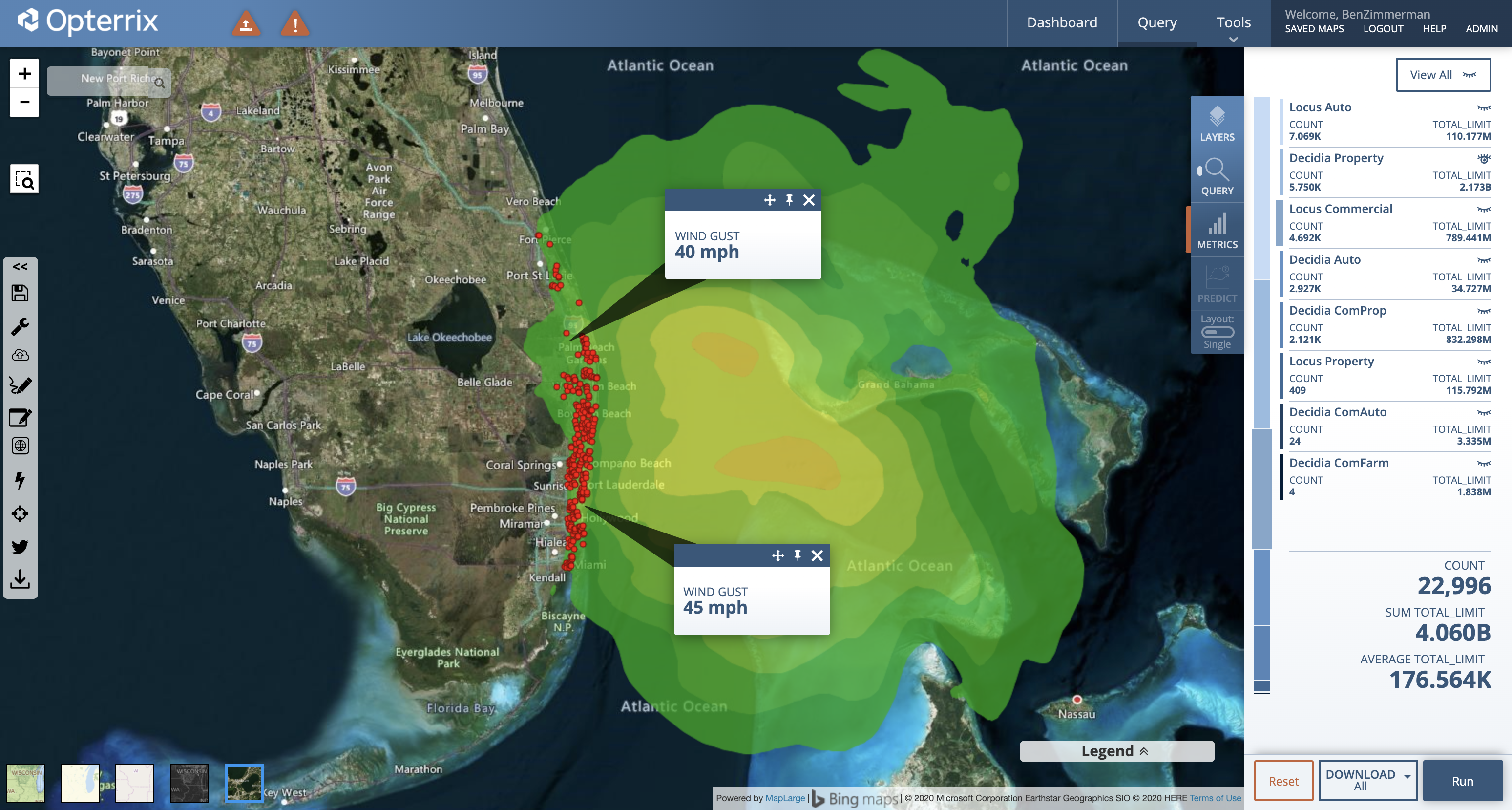
Tropical Storm Isaias (ees-ah-EE-ahs) continues to move along Florida’s east cost, bringing strong winds and storm surge. The center of Isaias had 65 mph winds and was positioned 55 miles southeast of Fort Pierce, Florida, moving north-northwest at 8 mph. Tropical Storm Isaias is no longer forecast to regain hurricane strength, according to the National Hurricane Center (NHC) during the 10 EDT update. Attention will soon fall to the Carolina’s as Isaias’ trajectory shifts northward later today.
“Isaias is forecast to move north toward the Carolinas and potentially make landfall there Monday night, causing high winds, the NHC said. “Heavy rainfall totals are expected to cause potentially life-threatening flash flooding over the Carolinas and then the mid-Atlantic Monday and Tuesday as Isaias moves north,” the weather service warned.
Several forecast models are suggesting landfall between Charleston, SC and Wilmington, NC late Monday evening.
Opterrix provides state-of-the-art visualizations and predictive analytics to proactively optimize enterprise risk management and insurance claims workflows.

