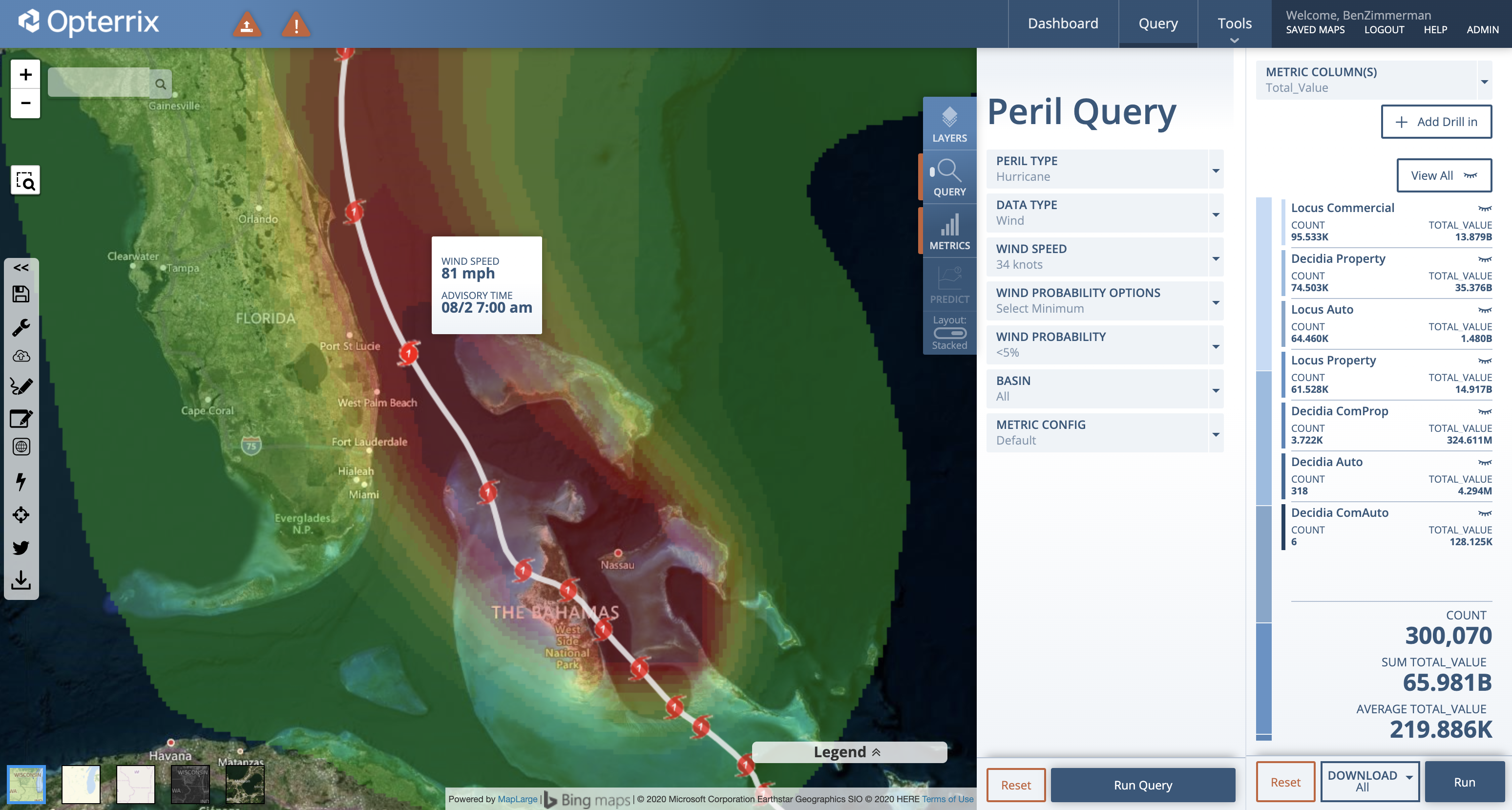
Hurricane Isaias (ees-ah-EE-ahs) continues to move towards Florida at 12 mph with maximum sustained winds of 75 mph. The forecast track of Isaias currently keeps the center of the storm just east of the Florida coastline, but heavy winds and a dangerous storm surge, combined with tides could generate over 4 feet of coastal flooding.
“Although Isaias has weakened after passing over Andros Island, some re-strengthening is expected tonight and Sunday morning when the cyclone will be moving over the warm waters of the Straits of Florida and the Gulf Stream,” stated the National Hurricane Center (NHC) during the 2PM EDT public advisory update.
“Isaias is forecast to remain a hurricane through Monday, followed by slow weakening beginning Monday night or Tuesday.”
Isaias will continue to impact the Florida and Georgia coastline this weekend and is expected to make landfall in the Carolinas early next week.
Opterrix provides state-of-the-art visualizations and predictive analytics to proactively optimize enterprise risk management and insurance claims workflows.

